Monday, 21 May 2018

From Barra to Barrow

It isn't a recognised cycle route but perhaps it should be.  It covers some of the best scenery, and hills, in Britain.  Barra and Barrow-in-Furness have several things in common: they're both the most southerly point of their region, they both have an airport, and acres of sand and sea.  However, when a young lady from Barra died recently, everyone went to her funeral.  That is unlikely in Barrow.

From Ravenglass it's mixed riding: tracks, lanes and the main road, round the Esk estuary, past the Queen's supplier of Cumberland sausages, over a couple of angry young fells while their dad looked down on us.  On one of these deserted lanes, I came to a tiny village with a sign proclaiming "Traffic Calmed Area".  There was no traffic, so it had definitely worked.  Just a couple of very calm parked cars.

Across acres of sand and the river Duddon, I could see the Furness peninsula, the far south west of the Lake District. Past sunny Haverigg, where there is a naturist campsite... Then round a weird three mile sort of harbour wall enclosing a large harbour, except there was no entrance to the harbour.  It seemed to be a very large man-made bird sanctuary.  I asked a lady with a big camera what she was photographing.  "They're Sandwich terns."

Which reminded me.  It was lunchtime.  Lovely pint of Singletrack black IPA, just for rehydration after a hard morning.  And speaking of birds, I saw a firecrest near St. Bees, and a little egret, near the Sandwich terns.

Today has been warm: most days so far have started quite chilly and warmed up but today was the first day I started in shorts and short sleeves.  There is still the tiresome southerly wind though.

After going north again to cross the Duddon, I knew I was in Furness as every place name ended with-in-Furness.  Broughton-, Askam-, Kirkby- and Barrow-in-Furness.  Similar varied riding all day, with smashing views of the sea coming in over the mudflats, and the larger southern fells (maybe Coniston?) in the background.  By coincidence, I crossed all three of the manually operated level crossings on the Cumbrian coast railway, each with their own signalman, and one rather scary self-operated one.

The main roads were quiet, until I got the motorway-like A590 the last few miles into Barrow.  And Barrow - well, that's another story.

It was a tough day. Lots of small and very steep hills, hot and sticky against the headwind, and despite the views, the miles seemed to tick by very slowly.

To Ravensglass - pics

To Ravenglass

After my fabulous meal I lay in my tent for a while with the door open, watching the sunset, listening to the birds,  and counting my blessings.  It took a long time. I won't list them all (too embarrassing) but I single out the weather, and my health.  Or is that "double out"?  To have a week of dry weather and quite a bit of sunshine, is unexpected and makes everything so much more enjoyable.  And to be healthy enough to do this trip - well, I'm very fortunate.

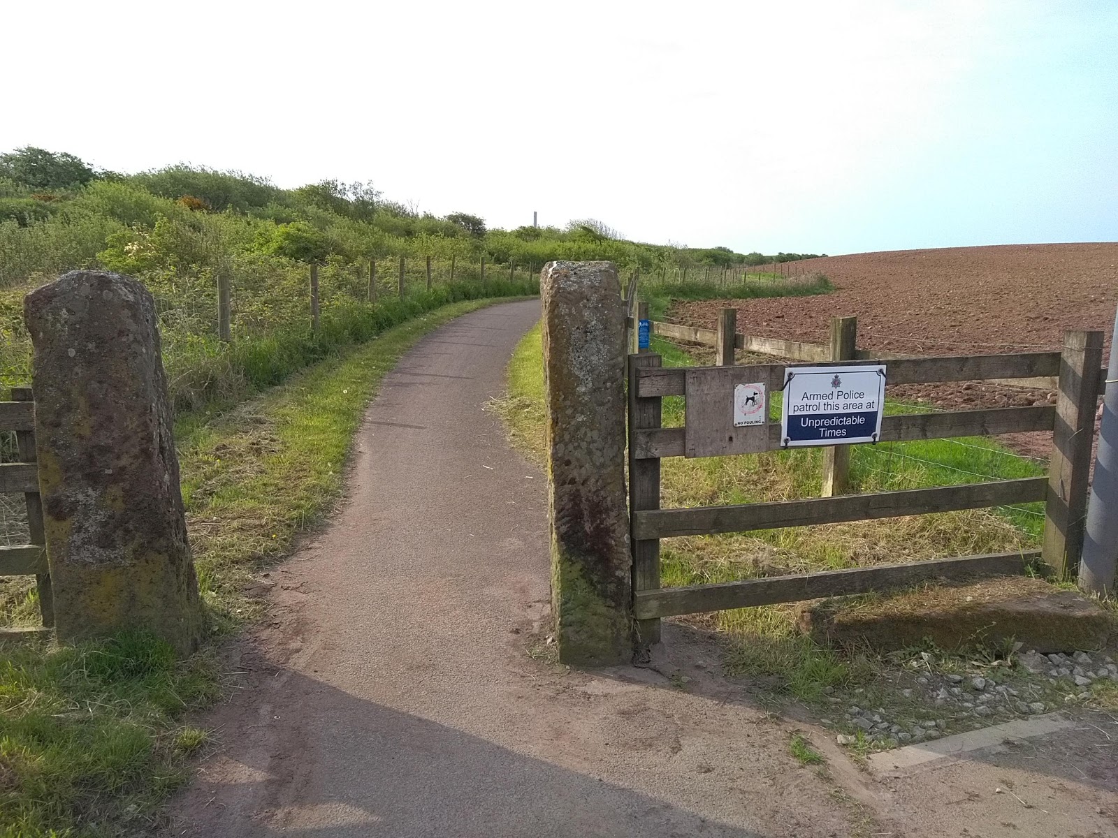
Anyway, enough of that sentimental stuff.   Climbing out of St. Bees I found an empty clifftop lane, with the sun and a few lambs for company.  Over the horizon loomed the industrial monstrosity of Sellafield nuclear processing site.  A sign on the cycle path warned "Armed Police patrol this area at Unpredictable Times".  I was on an old railway line, looking anxiously in the bushes in case they were lurking there.   Past the most serious security fence I've ever seen, including you-know-where, and then, there were the armed police at the main gate, rather predictably I thought, but decided not to tell them.

Then it was an Exciting Track, bumpy, sandy, narrow, but along the beach edge and bordered with wild roses; a bit of road, and another beachside track which looked tidal to me.  I was in Ravensglass, so I stopped for breakfast at the Ravensglass & Eskdale Railway station, sitting in the sun.   This is what riding round the coast should be like.

Sunday, 20 May 2018

St. Bees - pics

St. Bees

From Maryport the next fourteen miles are a mix of cycle track next to the railway line, and a bit of road, passing through a succession of places, largest being Workington, with a big port although I couldn't detect any activity. It is Sunday, I suppose, but I got the impression that the port may be in decline.  

Workington marked the end of the flat part of the route and the start of hills.  A very steep, very rough cycle track out of Harrington came as a nasty surprise.  Whitehaven was the next large town, with a busy harbour but, surprisingly, no cafés, apart from Costa and Gregg's.  I ended up in a bistro type place, where I had a started and a dessert in place of cake.

Took a risk and went over the cliff path from Whitehaven. Very steep to start, and then on a disused railway line climbing to the top, before descending to Sandwith, and inner to St. Bees. A very enjoyable route, which can't be said about most of the previous section.

St. Bees has happy memories for me.  In August 2004, Tim, Ed and myself walked the Coast to Coast walk, 192 miles to Robin Hood's Bay.  It poured with rain and we had to wade along flooded roads in Swaledale.  Tim was 14 and Ed was just 13, so it was a big adventure and a huge achievement for them. And me!

I'm camping this time. Arrived after they closed again so it's £10 through the letter box if I leave early.  I took a few pics of the start of the C2C and over a lovely curry I read my diary from our walk in 2012.  "..Boys seem very friendly up, although they still like to hold my hand...".  Happy times.

Back to England - pics 2

Back to England - pics