Saturday, 19 July 2014

An unexpected break in Thurso

As a result of missing the ferry to Hoy, I had a free afternoon in Thurso, which happened to be hosting the Caithness County Show.  It was very agriculture-focused,  with rows of pens of rosette-bearing sheep, cows and bulls. Impressive amounts of shiny farm machinery.

Everyone seemed to be there - young girls competing with great concentration in the highland dancing, accompanied by a teenaged boy piper in full highland dress.  Older girls leaping onto running horses in the ring and then showing every which way not to sit on a horse.  Nobody was trampled.  Exhibitions of flowers,  school art, photography, baking.  More baking. There were marquees full of  mouth-watering entries. 

The rest of Thurso is fine but it's just a town. A CTC winged wheel outside the Pentland Hotel.   In the museum,  a core from the nuclear reactor at Dounreay, surprisingly small at about 25 cm across and 1 metre high - considering it could produce enough power to supply the whole of Thurso.   I was glad to have bought my lead-lined radiation-proof underpants with me.  You never know when you might need rhem.

The old plan of Hoy

Lerwick looked lovely as we left.  On the ferry, an unexpected treat: we were trailed by the coastguard helicopter for half an hour, hovering maybe ten yards off our beam, rounding off by winching a man onto the ferry, and then off again.  Five hours and 150 miles later, I was back in the welcoming arms of Kirkwall Youth Hostel.

I had a cunning plan for today, involving three ferries and Hoy.  I had to leave early for Stromness, get the passenger ferry to Hoy, cycle its length down its only road to Lyness, and back on the car ferry to Houton.  Careful study of the timetables told me that I had to be on the 14:00 ferry off Hoy, so I would be in time to cycle back to Stromness for the last ferry to the mainland at 16:45.  A cunning plan indeed but with enough contingency to just cause a frisson of excitement at the delicious possibilities of getting stuck on Hoy, or Orkney.

I got to Stromness an hour early for the 10:00 ferry, left my panniers in the left luggage, at £3 not as good value as Bixter post office, but well worth it for a windy day's ride.  Found the right ferry, already waiting at the pier.  Just time for a cooked breakfast and cuppa, perfect.

Or not.  When I returned at 9:45 I had difficulty locating the ferry.  Found the place but no ferry.  Inspection of my carefully prepared plan: "Ferry Stromness to Linkness 7.45, 10.00, 1600 (Sat/Sun 9.30 & 16:00)".  Oh.  There was no way to get to Hoy and get back to the mainland today, Saturday.  That's the trouble with plans - they create expectations, which can lead to disappointment.   Sorry, Hoy. Another time, I hope.

Collected panniers,  £3 for an hour not cycling, caught the 11.00 ferry back to Scrabster for an afternoon at leisure in Thurso.  Buying my ticket, I was asked, for the first time ever,  if any concessions apply. 

As we left, we passed the little ferry returning from Hoy.  Lovely views of Hoy's cliffs and the Old Man as we sailed by.

Friday, 18 July 2014

Headin' Doon Sooth

As Ieft the B&B the owner asked "Are ye headin' back doon Sooth?"  Well no I thought, thinking of London and 30 degrees: but yes I said,  I was heading back to Orkney. John O'Groats was 170 miles south, never mind London.

I realised I would miss Yell.  A calm, grey windless morning, 13 degrees.  As I cycled along the undulating, empty road down the west of Yell, the oystercatchers said goodbye with their pip, pip, pip alarm call, and a couple of arctic terns half-heartedly attacked me.  Lambs scurried to hide behind their mothers, alarmed at this strange MAMIL lumbering up the hill.

To my left a panorama of the thin strip of  sea separating Yell and the mainland, maybe a dozen low grassy islands dotting the calm water, and an orange flare from Sullom Voe on the horizon.   I crested the hill to see the ferry at the terminal half a mile away: this had happened with every ferry crossing to Yell and Unst, and 3 out of 4 times I had missed the ferry.  But it didn't matter: ferries were frequent and it was a nice day.

Lerwick was achieved by a series of detours on minor roads near the east coast: each going nowhere in particular but with lovely views.  I stopped at a shop where two locals were telling how it had been much too hot when they visited Edinburgh: 23 degrees.

Over the now familiar big hill and there was Lerwick, glistening like a jewel in the afternoon sun against a bright blue sea

Thursday, 17 July 2014

End Of Cycle Route: Unst

NCN route one ends at the top of Unst, the northernmost island.  I caught the ferry from Gutcher to Belmont at the south of Unst and made my way north, against the wind and mist.  Sadly there is no sign to mark the end of NCN1 but I went to where I think it should be.

Despite Unst being such a far-flung place, it was very welcoming.   I counted five cafés -not bad for a small island. I regret that I didn't have time to try them all.

As I passed Britain's Northernmost Church the sun came out.  Heatwave!  London 28 degrees, Shetland 15, which was plenty for cycling.  It was a short and pretty ride to the picturesque visitor centre at Hermanness, the nearest I got to the RSPB reserve on the rocky islet of Muckle Flugga.  I believe you can get boat trips there.

Then past Britain's Northernmost Post Box to Norwick where I had planned a sort of victory lap without realising it contained the Northernmost Steepest Hill.  Beautiful views over the beach and a rocky promontory which could have been the end of Britain.  A little further on the Northernmost Inhabited House at Skaw overlooked a lovely sandy beach. 

I planned to return down the Steepest Hill down a cliff-side road, but there was a gate across it and it clearly wasn't used much.  Exercising my right to roam, I went down, and about halfway down I discovered the reason for the gate.  A 50 yard section of road had slid maybe half a metre down the cliff,  leaving big cracks in the tarmac.  A quick risk assessment was done.  Dry weather = firm cliffs + light-ish bike = low risk. Versus the risk of having to go back up aforementioned hill.  I proceeded carefully on foot.  Two further gates at the bottom were securely closed and labelled DANGER ROAD CLOSED.  Too late.  Maybe that's where NCN1 ends.

Back to Haroldswick to try out a café enticingly called The Last Resort.  Very good too.  Then back home to the B&B, via a surprisingly hilly detour to Gloup, which was another farm at the end of a road experience.   A bit disappointing unless you liked hills, which at that time of day, I didn't.

Wednesday, 16 July 2014

Northmavine

As I write I'm recovering in a second B&B - luxury. The one last night was very nice except its location which was about three unwelcome and hilly miles of town. It overlooked another voe, so after settling in I walked down to the beach and had a moment's peace while the sun set.  Priceless.

Today I explored the north-west mainland, which is called Northmavine.  Not much happens there.  I left my bags in nearby Brae, at the helpful building suppliers - please do use them if you need any building supplies.  Went north 10 miles, west 10 miles to Eshaness where there is a lighthouse to mark the most westerly point, an interesting museum, great views of beaches, sea stacks, rugged cliffs - and a campsite café selling cake!  My first of the trip. Well worth a visit.

Then back 10 miles and north 10 miles, to Isbister, near the furthest north point.  What an anticlimax.  The road just petered out in a farm.  No café,  toilets, nothing.  Toilets were becoming important after the previous café stop.  The roads are very open and there are no bushes to hide behind.
An interesting diversion was nearby.  The farm was surrounded by a crescent of hills and a winding driveway led up to a house halfway up this hill.  In the front garden was parked - an aeroplane.  Not a light aircraft: a small airliner, maybe 40 seats?  How it got up there I can't imagine.  Apparently the owner bought it when it was being scrapped to do up.  Had it transported from Sumburgh airport - at the other end of Shetland. Is bonkers, surely.

Then it was back 10 miles south, with a diversion over a very big hill to see the sea ans visit the shop ( ro be told that the shop was 'at the top of the town' I.e. up another very big hill.  This is taking out of town shopping to new heights (ha ha- geddit? ).

Another smaller diversion to the village of Sullom, where I hoped to catch a view of Sullom Voe, a huge oil processing site, the biggest in Europe. No luck: it is extremely well hidden, probably about good thing. Then - are you following? - another 10 miles south to my starting point at Brae Building Supplies.  Highly recommended.

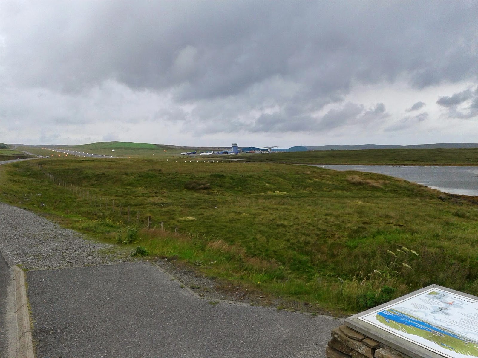
It had been raining for a while now so I pressed on towards the island of Yell.  Past the airport of Sullom Voe, the road running parallel to the runway about five metres away.   Flashing lights stop traffic while planes take off,  which is a pity as it would have been a great Top Gun moment, though not as good as last year with the fighters at Lossiemouth.  A helicopter landed right next to me as I cycled past.  Nobody returned my friendly wave.

I had low expectations of the town of Mossbank, near the ferry, and they were met.  Another out-of-town shop, a long road over a hill and down to - not much.  There was a pub, but it looked like it hadn't been open for awhile.

Arrived at the ferry in the rain.   Shouted "IS THIS THE YELL FERRY?" to the security man. "No need to shout" he replied.  "But I thought it was the ... oh, never mind"
I had been looking forward to a little something in the ferry's restaurant,  but it wasn't that sort of ferry.

Once on Yell I went the long way round to my B&B, via a lovely single track road and various villages th at might have looked lovely if the sun was shining and I was less tired, but it wasn't and I was and they didn't. I stopped briefly at Britain's Northernmost Pub, in Mid Yell, to enquire about food for tomorrow, but there was none on offer.

I wish someone phoned me just then, so I could say I was interrupted in Mid Yell, but there is no phone reception there. Another dream dashed.  Then cycled to the B&B as fast as possible, which was very slowly, to arrive tired, wet, with filthy panniers, and late for my evening meal.

Shetland

How to sum up the place?  Well it's beautiful landscape - mostly open grassland, very few trees or hedges.  Big hills like Lakeland fells.  Agriculture seems largely to be sheep farming and associated haymaking.  There are some of those sweet little ponies - what are they called? - around too.

Water is everywhere.   Lochs dot the landscape and the coastline has valleys which have been gradually flooded by the sea creating the voes everywhere and the scalloped coastline which is so pretty.  And while most land is covered by grass or low scrub, the verges of the roads are crammed with flowers at the moment: clumps of giant purple clover, campions, and a variety of yellow flowers I don't recognise.

And the roads!  Wonderful smooth tarmac.  I have hardly seen a single pothole.  Every tiny crack has already been marked for repair,  even on the smallest roads.  Few vehicles, and considerate drivers.  The downhills are long, open, smooth, fast; the uphells are, well, long. (Did I spell that right?)

The people seem industrious snd helpful.  The cars you see are purposeful - the district nurse, postman, and many workers' vans.  I guess people don't come to Shetland for an easy life.  Most live in very small groups of houses away from amenities.  But every village seems to have an active community; a community shop, a campaign to save the local school, a curry night on Wednesday in the village hall, a toilet-themed garden outside the public loo (really!).

I guess the main industries are fishing, farming, tourism and the big money-earner, oil.  With a surprisingly mild climate, it has a lot going for it if you don't need a convenient shopping mall, secondary school (boarding school at Lerwick I believe) or need to be somewhere else for work.

Oh, and there is the Norse influence too.  Shetland and Orkney used to belong to Norway until the late 1400s, when they were sold to Scotland as part of a dowry for James III's wife, I think.  Most people feel more Norwegian than Scottish - interesting when independence is being discussed.

Well I hope you like the essay...  normal service will be resumed soon.

Tuesday, 15 July 2014

The long and windy road

Today was a big day: a three Lucozade day. It was grey and drizzling when I left the hostel.  The blue Shetland flags were flying horizontal in the wind.  There was only one thing to do.  I got on the bike and set off next door for breakfast.  Fighting against the wind I climbed over the hills out of Lerwick. Downhill was more difficult too with the wind trying to snatch a the handlebars.

My route took me due west, exploring the western mainland in two big loops and a dead-end ride before heading north to Muckle Roe near Brae for the night.  After 20 miles I stopped at Bixter post office for elevenses, and had the bright idea of leaving my panniers for my return.

Starting the first loop south to Skeld there was a Road Closed sign.  Normally cyclists can pass ok, but this was serious.  A stretch of 100 metres of tarmac was removed and there was a deep trench, maybe 5 metres wide, across the road.  A crane was working to replace a bridge.  With the ok from the workmen, I was able to scramble down and across.  The rest of the loop had fine views of the sea and fine hills: no settlements more than a few houses.

I was looking forward to lunch in the bakery café at Walls, but it had closed, so I had a sandwich instead.
Things only started to look up when I reached the furthest west point of the route and headed back up the Vale of Walls.  A gentle climb with the wind behind me: followed by a detour to Sandwick to the north.  The sun came out a bit. With a Belgian couple we watched gannets plummeting into the sea, and wondered what living here would be like.

After climbing out of Sandwick it seemed to be downhill all the way back to Bixter, passing many small lochs in lovely scenery.  Panniers recovered I took the Twatt road ... to the village of the same name, which had amused the childish part of my brain (most of it) for a lot of the day.  More big scenic hills on the way north via a pub meal at the village of Voe.  There are lots of Voes on Shetland: it means an inlet  or sea loch, but I think this is the only town.