Monday, 15 May 2023

Goodbye, Exmoor

What a day!  Only a pathetic 30 miles, and an unimpressive 1050m of climbing - I think it was six of the threatened 14 climbs.  But it was a full value day, very scenic with lots of reasons to stop to take pictures,  and several lengthy cafe stops.  And maybe Exmoor climbing counts for more somehow?  The weather really helped, a cold (head)wind but warm sunshine, bringing out the colours.   The hedgerows, very tall around here, are a riot of red, white and blue, no doubt specially planned for the coronation. 

Lynton town hall

I sat in a nice cafe in Lynton, relaxing in the knowledge that there were a surprising four hostels in Lynton, according to my research.  But no, when I eventually raised energy to decide which one to book - they were near Lynton, but not in Lynton.  Most involved going back the way I'd come, which wasn't going to happen.  Everywhere's either up or down from Lynton, even other places in Lynton.  No nearby campsites either, except one up a big, off-route hill.  I settled on a guest house in Lynton, so an easy night for me.   Lynton is a nice town, apart from the hills everywhere.  Even the town is on many levels, making for confusing navigation (for me at least).  In the guest house I met a fellow traveller, John, who was walking from John o'Groats to Lands End, in three indirect stages, includingthe West Highland way.  He gave us a fairly graphic account of his six blisters.  His luggage was being transferred to his next night's accommodation for him, which sounded appealing.

Valley Of Stones

Lee Abbey - Crosses on the hill

Lee Bay

After Lynton came a couple of miles of the nost spectacular coastal riding.  In perfect sunny weather, I descended through the Valley Of Rocks, past Lee Abbey, a Christian community, to beautiful Lee Bay, on another toll toad.   After that, things could only go up, so I climbed up through the trees to the high moors, and along the top for a bit before descending to the Heddon Valley.


Down to the Heddon valley

Immediately I climbed almost vertically to Trentishoe, "not suitable for vehicles".  It was not suitable for a loaded bike either.  Finally it eased off a bit and I just had another 100m of climbing to my final summit in Exmoor, 301 metres high and possibly the highest place I will visit in the rest of my coastal trip?  I had done 450m of climbing in 7 miles.  It was time for elevenses,  which I had in Combe Martin, in the next valley.


The last Exmoor peak

Combe Martin 

Goodbye Exmoor, it's been memorable.

Porlock


I only had to follow the valley of the river Aller to get to Porlock, in theory.   Selworthy Green, where I rejoined the road, was a picturesque hamlet with thatched cottages, at least one of them open to the public via the National Trust.  The road was even steeper down than the track!  And then my route took a surprising turn, onto a track, avoiding the dreaded A39 by following an ancient cobbled track.  It was OK except where the surface had degenerated into loose stones in a few places.   The Aller valley was beautiful and took me into Porlock.

Selworthy Green 


Porlock itself was a bit disappointing, maybe because I was looking for a nice cafe, but it seemed very hemmed-in by buildings almost squeezing the road, with narrow pavements and a lack of space.  Maybe I missed something.  A couple of miles to the west was Porlock Weir, which is really a harbour, and it was quite a contrast.  A beautiful sunny situation with harbour, lock, and fisherman's cottages, and plenty of refreshment places for tourists.  I sampled one overlooking the harbour, served by a very laid-back chap.  When I asked if I should pay now or later, he said "there are no rules", adding, for emphasis, "there are no rules".

Porlock Weir 

Fishermen's cottages

This isn't the toll road you're looking for

There are three ways out of Porlock.  The A39, and no less than two toll roads, created by different landowners.  The one nearer the sea is poorly maintained and currently closed, so I used the other one,  owned by Porlock Manor.  For the price of £1 you get a well-engineered road through woodland at a nearly constant 9% gradient.  I settled down for a 400 metre climb, and four miles later I was at the top after paying £1 to the toll keeper, who admired my bike's steel frame, perhaps hoping for a tip.  It was a nice way up.

Toll booth

What's this?

Down the other side, I descended (steeply) into the valley of the East Lyn river, following the awful road to Malmsmead,.   The road was covered with debris  mud and stones from the fields.  It may have been very pretty, but I didn't dare to look.  At Malmsmead  I crossed the river into Devon.  Lorna Doone country, the sign proclaimed.  In the novel, she lived in this very valley.  It is certainly striking, with a very deep, narrow, steep sided and wooded valley, so the sides tower above you.  And worrying too, as I knew I had to climb out of the valley further on, which I did on a 20-25% slope.


East Lyn Valley

Into Lynmouth

I was now on the way to Lynmouth, descending (a long way) with the river in its narrow valley until the town appeared.  It's a small town, squeezed into the valley with quite a wide river at that point.  Pretty nice for its size, and very touristy.  Like several north Devon & Cornwall towns in steep valleys, it had a serious flood in 1952, and again in 2014.

Lynmouth


It's twin, Lynton, is extremely unlikely ever to flood.  Perched on top of a cliff overlooking Lynmouth, and connected by a cliff railway, or in my case, the A39.  It was a killer climb, 25% all the way up, one which I never want to do again.

Up to Lynton (literally)


Cliff railway

Climb 1 of 14

Today is going to be brutal.  As far as I can work out, 2000 metres of climbing in about 50 miles.  That's well beyond ridiculous on my scale of hilliness, at 400%.   First, I will ascend Selworthy Beacon, nearly 300 metres with a viewpoint at the top.  It's a dead-end road, so I will then attempt to descend a bridleway to Selworthy.  Along the valley for a few miles, to Porlock.  Honestly, who planned this??  It is a pointless climb, but that is the point, I suppose.   The journey, and the discoveries along the way, are the point.
Minehead


Kindness of strangers

Minehead harbour

Thatcher (in his van, left)


I slept well but woke at 5.30 again,  so I had an early start.  A double breakfast of porridge with banana and honey, and beans on toast, set me up for the day.  The sun was shining, with a brisk and cool north westerly wind.  Minehead looked beautiful.  It is a lovely town, with a harbour to the west, main beach by the town and station, and Butlins out of town to the east.

Loading up the Garmin, it told me there were 62 miles and nearly 3000 metres of climbing.  My main aim today is that my legs survive for another day, so if I can get to Lynton, around the 50 mile mark, I will be happy.

Into the Park


Climbing out of town to Selworthy Beacon was slow but nice.  Gentle hairpins took me up beautiful North Hill, and then I was in the Exmoor national park, not so gentle climbing among the gorse and the ponies.  I had plenty of time to study the roadside violets and tiny dewy cobwebs in the grass.  Even the dandelions held a fascination, compared to looking at where I had to go.

I'm writing this on top of the moor, surrounded by gorse and views, in the company of many bees and the birdsong.


As I climbed the views opened out; Minehead and the bay glittering behind me, and high moors across the valley to the south.  I caught occasional views of the Welsh coast across the Channel. It was very quiet, unsurprisingly for a dead-end road.  At the end, a stunning view of the cliffs from Porlock to Foreland Point greeted me.   Then I turned back, for the bridleway down off the Moor.

I was apprehensive.  What if it was impassable - overgrown deep mud?  But I didn't need to worry.  It was a wide path, stony or grassy, sometimes too steep to ride, descending from moorland to woodland and then beside a river gorge, to arrive in Selworthy Green.


Sunday, 14 May 2023

To Minehead

Reading is becoming my new favourite station.  It's the gateway to West Wales, and ialso the south west.  However GWR is not my favourrail company.  I gad a good journey there, leaving Southall at 8 on the Elizabeth line.  I seemed to have dodged the rail strikes, and also the promised 20 degree weather.  I shivered on Reading Station for an hour awaiting my train, which was a bit of a disaster bike-wise.  The platform guard was lelping a lady with two very large suitcases, and wanted to store them in one of rhe bike storage spaces, so directed me to the other tiny space at the other end of the platform, after the train had arrived.  I sprinted the length of the train, only to find two bikes and a drinks trolley already janned in there.  I forced my bike onto the train, completely blocking the gangway, and the train set off.   Very unsatisfactory. 

Eventually the train guard came across the bike-jam, and, after checking we all had reservations, found an unadvertised bike space for me, so another sprint down the platform at Westbury had me travelling comfortably for the final hour.
North Petherton, of M5 services fame

Just round the corner from Taunton Station, I joined the towpath of the Bridgwater canal, which was lovely, and took me most of the way to, er, Bridgwater, visiting a few nice villages on the way.  Much warmer by now, the air was thick with the scent of cow parsley and hawthorn blossom.  I spotted a kingfisher dashing along the canal towards me.  I've booked a hostel in Minehead tonight, so I couldn't linger too much.
Bridgwater,  Fisherman's Wharf

A late lunch in Bridgwater set me up for the main ride to Minehead, zigzagging on quiet, pretty roads to avoid the main A39 road.  It was nice to hear Westcountry accents in the cafe and to be addressed as "my love". 

The sun was out by now and it was warm  with a fresh headwind.  After a couple of miles I was stopped by a chap on a rather muddy bike.  It wasn't mud.  A slurry tanker had overturned on the lane ahead, blocking the road and spreading its contents liberally.  I asked if I could get through, and he looked at my clean yellow panniers doubtfully.  It wasn't a good idea, so I detoured around the spillage, cycling with a local lady for a while until the pretty village of Cannington.  
Cannington

Is it this way?

Cycle path ...?

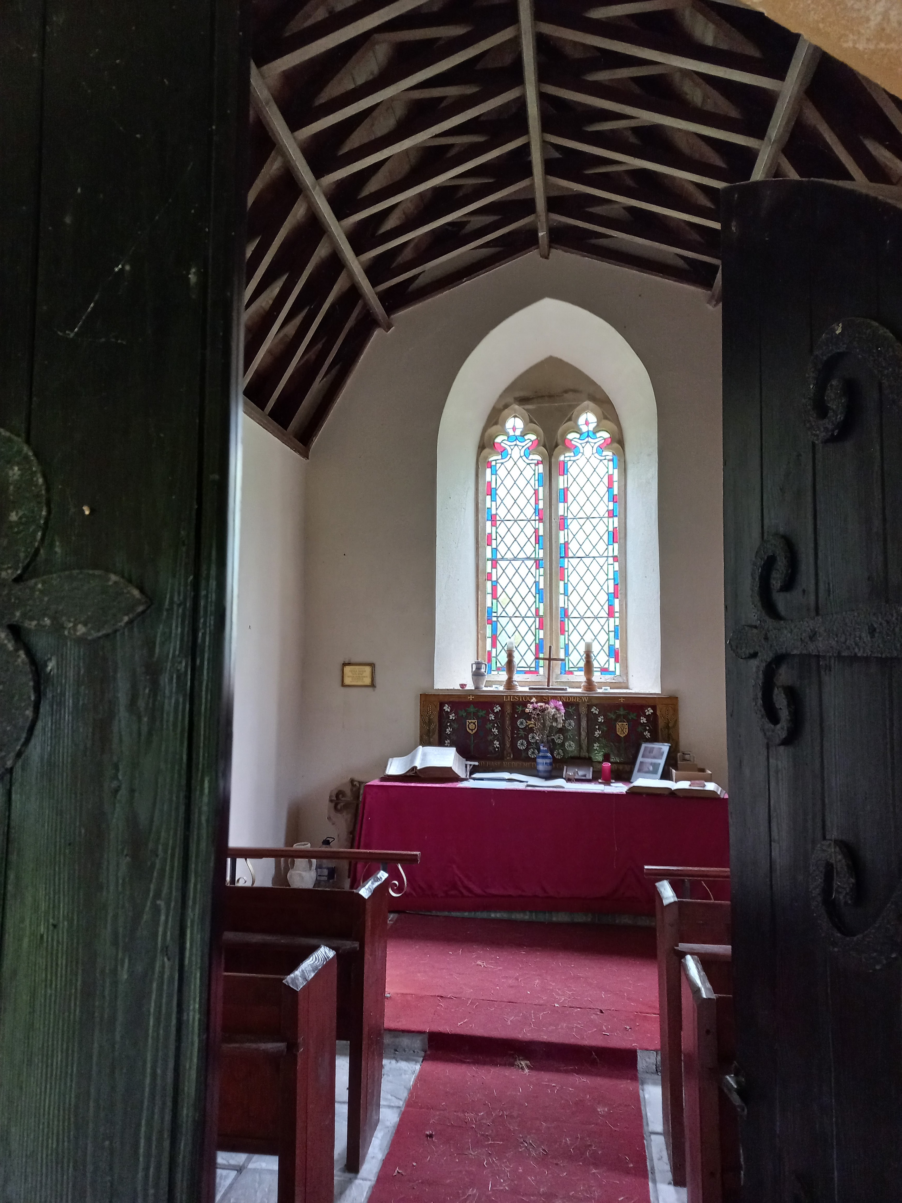
Tiny church in the middle of nowhere


Pews seat maybe eight people

A lot more lanes and a few short stretches on the horrid A39, and about 20 miles after Bridgwater I had my first view of the sea.  My first seaside town was very safety-conscious, as they had signs everywhere saying "Watchet".  I saw no accidents while I was there, and I was very lucky to get the last cup up tea and cake from the last cafe to shut, at 5pm.  Watchet is a pretty, old town with quaint back streets, inexplicably with no seafront, just a large and boring marina.  Where the town touched the sea, there was a large hoarding, maybe a site for exclusive seaside apartments.   It would be totally out of place if so.  Watchet also has a steam train line to Minehead, the west Somerset line.  I would have shown you an action photo of a steam train chuffing out of the station, but I was on the phone leaving a message for my hostel at the time.
Watchet!


Radio museum,  ironically in Watchet

Despite the attention to safety, there was a problem.  Part of the B road to Minehead had fallen into the sea.  Careless!  The diversion was via the horrid A39.  I wasn't looking forward to toiling up some big hills with impatient drivers queueing behind me, and luckily the café proprietor offered an alternative,  torn between his desire to help me and his desire to get me out of the café so he could close up.  A few back roads, and I could follow the Mineral Path out of town.   It turned out to be a disused railway, lovely right up to the point where he said cross the (actual) railway and follow the path back to the B road.  It was nearly as bad as one of David Ward's off-road adventures!  When I came to a stile, I knew the game was up  and continued on the mineral path instead, which was fine and maybe saved me a hill.
Mineral path

Not this way ...

Soon I was in Blue Anchor, a seaside town which seemed to consist of a pub (the Blue Anchor) and several caravan parks.  Minehead was visible in the distance, so I passed through quickly and headed to Minehead.   I had to bypass Dunster, which lilooked interesting, with a castle on a hill,  as it was getting late.
Blue Anchor

Minehead 

Minehead 

Minehead.  Nice, big place.  A Butlins holiday camp to the east of the town, but the town itself is a proper town.  It looks sort of Alpine, against a backdrop of big steep hills.  All that's missing is the snow - thank goodness.  The hostel was up the main street, The Parade, past lots of shops which would be worth a look around if you like that sort of thing.  I don't, and anyway I had things to do.  I found the hostel, a run-down house, and tried to phone to say I'd arrived.  Voicemail.
Hostel

No doorbell.  Was there anyone in?  I briefly contemplated camping in the overgrown front garden, before noticing an envelope pinned to the door frame.  It had keys and instructions for paying  so all was good.  I showered, did my washing, and went out on the town.   I needed somewhere doing basic food, not too pricey, with a pint for rehydration.   Fortunately there was a perfect place just on The Parade, the Duke of Wellington, converted from a vast, grand hotel by the look of it, and still operating as a Wetherspoons hotel.  The Simple Scampi was exactly what it said on the tin, four pieces of scampi with lashings of chips and peas.

All is good.  A good first day.  Tomorrow  ... Exmoor ... and Porlock.

PS.  Sorry for the long post.  I'm excited to be back on the road.  I'll try to be less excited tomorrow. 

Saturday, 13 May 2023

Westward Ho!

No, not the town, just my general direction of travel.   I am setting off tomorrow to continue my trip round the coast.   It's ten years since I started my ride, leaving London to ride up the east coast of England, a fresh-faced, newly retired lad still in short cycling trousers.  With a bit of maths, I have worked out that it makes me ten years older now, and supposedly with ten years experience under my belt, which is why my belt is a bit tighter these days.


I'm re-joining my route tomorrow lunchtime at Bridgwater, after cycling from Taunton station.  I am as excited as ever about starting out into the unknown, but also a bit wary of how my legs will cope.   I have heard there are hills in the south west.   People who have cycled Lands End to John O'Groats say that the south west is the hilliest part of the ride.   There is a place called Exmoor, and something else called Porlock Hill.   Also, I just noticed the Quantock Hills in the picture above.  And the North Devon AONH  (Area of Outstanding Natural Hilliness).    It doesn't help that all the lovely seaside villages have been built at sea level, so most of them involve a steep descent and then ascent again.    With this in mind, and bearing in mind that my legs gave out after about five days (admittedly five days of drizzle and rain) last year, I have not set a target for where I want to get to.   It has never been about the destination; it's about the journey.  And there are loads of gorgeous places that I'm looking forward to seeing.   (Westward Ho! is one of them).

I do hope you will join me for the journey, in spirit at least.   I will aim to post an update and a few photos every day, so please do take a look at this blog to see how I'm getting on.